

Blog
Garmin eTrex 22x Rugged GPS Navigator — Outdoor Navigation Guide
May
Keeps you on the trail when your phone gives up — a tough, pocket-ready backup you can trust.
You know that sinking feeling when your phone dies, the trail map blurs, and you start to doubt every turn? Losing signal or a drained battery can turn a great hike into a tense scramble — and that’s the last thing you want when you’re miles from the car. The Garmin eTrex 22x is a small, rugged handheld GPS that does one thing well: keeps you on the trail when your phone can’t.
It runs on easy-to-find AA batteries, shrugs off rain and bumps, and fits in your pocket so you can focus on the view instead of worrying about navigation. For day hikes or as a trusted backup on longer trips, it’s the kind of simple, reliable gear that lets you breathe a little easier out there.
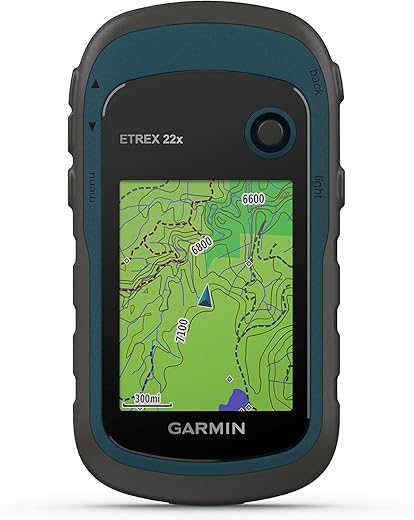
Garmin eTrex 22x Rugged GPS Navigator

You get a dependable, battery-friendly navigation tool that won’t leave you stranded when your phone dies or signal drops. It’s built tough and keeps navigation simple — great as a primary unit for day hikes or a trusted backup for longer trips.
Ready for the trail (so you don’t panic when signals drop)
You know the feeling: your phone battery drains just when the trail forks, clouds move in, and the map on your screen blurs. The eTrex 22x is the kind of tool you reach for when you want something that just works — no charging ports in sight, no fragile glass, just a stout handheld that tells you where you are and how to get back.
This unit is compact but purposeful. It keeps the core job of navigation front and center: track recording, waypoint marking, following GPX routes, and reading topographic detail under sunlight. If you prize reliability over glitzy touchscreen tricks, this is the device that calms the tiny panics that happen out on the trail.
What sets it apart on the trail

In the field: navigation that stays simple
You won’t get a cluttered app experience here. The eTrex 22x keeps navigation focused: a clear map view, a compass/heading page, and a track log that records where you’ve been. If you like planning routes on your computer and then following them outdoors, the eTrex speaks your language — it accepts GPX files and shows your position relative to the track in real time.
Specs at a glance (quick table)
| Feature | What it means for you |
|---|---|
| Screen | 2.2″ color transflective — easy to read in daylight, small for fine detail |
| Maps & Memory | TopoActive preloaded, 8 GB internal + microSD slot — add map sets or regional tiles |
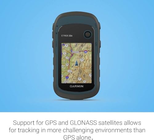
| Satellites | GPS + GLONASS — better locking in trees and canyons |
| Power | 2 AA batteries — replace anywhere; up to ~25 hours in GPS mode |
| Weight & Size | Lightweight and compact — pocketable for day hikes |
| Interface | Buttons + joystick, no touchscreen — reliable in harsh conditions |

Power: swapping stress for spare AAs
Where modern devices force you to find a wall outlet, the eTrex uses AA cells. That’s a huge comfort if you’re camping remote, traveling abroad, or planning multi-day trips where recharging is a pain. You can run it on alkaline, NiMH rechargeables, or lithium AAs for cold weather. The option to pick battery type in settings helps the unit estimate remaining runtime more accurately.
Built to take hits (literal and metaphorical)
This is not a delicate device. Sealed buttons, a grippy shell, and a splash/water rating mean you can use it in rain, mud, and snow. Because buttons are less prone to failure than touchscreens when wet or when you’re wearing gloves, you won’t be fiddling for minutes to input a waypoint.
Who should bring this on their next trip — and who shouldn’t
Quick tips so the eTrex actually saves your trip
Final outdoor-minded thoughts
This is a tool that trades bells and whistles for reliability. It won’t win awards for flashy UX, but its strengths are the things you care about when the weather turns: readable screen in sunlight, long battery life, and the confidence of a familiar button layout. For people who want navigation that just works — especially as a backup that won’t die when your phone does — this is a calming, no-nonsense companion.
If your hiking style includes multi-day adventures in remote areas, pair this unit with good map planning and a paper backup. If you mostly wander local trails and love touchscreen detail, keep your phone for situational awareness and the eTrex in your pack as the dependable fallback.
FAQ
Short answer: not exactly. The eTrex is designed to be a reliable navigation tool that keeps working when your phone battery dies or there’s no cell service. It lacks the large, detailed maps and app ecosystem of a smartphone, but it’s far more dependable off-grid. Use the phone for map detail and the eTrex as your navigation backup and track recorder.
You can copy GPX files and map tiles to the device over USB or put them on a microSD card. Planning routes on your computer is handy — export the GPX and import it to the eTrex. The microSD slot is recommended for bigger map sets so you don’t fill internal memory.
For cold conditions, lithium AA cells perform best — they last longer and tolerate low temps better than alkalines. Rechargeable NiMH are fine for routine use if you can recharge at base, but bring spares of a non-rechargeable type as an emergency backup.
Yes. GLONASS adds more satellites into the mix so the receiver can get a better positional fix in challenging environments like heavy canopy, deep valleys, or urban canyons. It won’t make the device magically perfect, but it reduces the chance of losing a reliable lock.
Yes — the screen uses a transflective display that reflects sunlight, so you’ll often need less backlight outdoors. It’s not as big or detailed as a phone, but it’s designed for outdoor visibility rather than indoor finesse.
Absolutely. The eTrex is well-suited for waypoints and track logging, making it a solid choice for geocaching. Export GPX cache files to the unit and use waypoints to navigate to cache coordinates.

Bought one last year as a backup to my phone. Love how rugged it feels — dropped it a couple times on rocky trails and it’s fine. Buttons can be fiddly if you’re wearing gloves though. Overall worth the $199.99 if you want reliability over flashy features.
Agreed. The physical buttons are a tradeoff: more durable, less intuitive than a touchscreen. I like them for winter hikes.
Glad it’s holding up, Marcus. Good point about the buttons — the non-touch interface is great with gloves once you get used to the layout, but it does take a little practice.
I’m split. The eTrex 22x is clearly dependable and well-built, but I keep thinking that Garmin’s higher-end models (with better screens and more features) might be a better long-term buy if you do serious navigation.
For casual hikers and as a backup, though, this makes perfect sense.
I started with the eTrex and moved up after a couple years. It was perfect for learning and as a backup during the upgrade.
If you plan to upgrade later, consider resale value — Garmin tends to hold value decently.
That’s a sensible take. The eTrex 22x excels as an affordable, reliable unit. If you need advanced mapping, larger displays, or more features, stepping up to Garmin’s mid/high-tier models is worth considering.
The review says ‘control method: voice’ — wait, what? Is there actually voice control on this unit or was that a typo? 😂
If there’s no touchscreen, voice would be a weird choice for a rugged hand-held GPS. Anyone clarify?
Good catch, Oliver. The eTrex 22x doesn’t have robust voice-command navigation like a smartphone. That ‘voice’ line is a quirk in the spec list — primary input is button-based. Sorry for the confusion!
If only it did — imagine yelling “recalculate” at a device on a windy ridge 😅
Yeah, no voice control here. I tried talking to it once and it ignored me. Technology’s fragile ego 😂
Nice, concise review — thanks! I like that the eTrex 22x is battery-friendly (25 hours is solid). I have a question though: does anyone know if the unit keeps track of multiple saved tracks well? I do multi-day hikes and like to compare days.
Also, the review mentions compatibility with microSD. Has anyone used a high-capacity card (64GB+) for lots of topo maps? Curious about any slowdowns or hiccups.
Good questions, Emily. The eTrex 22x handles multiple saved tracks fine — it’s designed for backcountry use, so you can store several tracks and review them afterwards. Regarding microSD cards: Garmin supports cards up to 32GB officially, but many users report 64GB working if formatted correctly. Performance is generally fine, but very large map sets can take longer to load.
I’ve used a 32GB microSD and had zero issues. For long backpacking trips I export daily tracks and clear the device every few days to keep things tidy.
I tried a 64GB once and it worked, but I did notice slightly longer boot/load times when loading full topo sets. YMMV.
Fun experiment: took mine on a foggy coastal hike and it was a lifesaver when the trail vanished into cloud. The GLONASS support made me feel better about satellite lock in crappy weather.
Small gripe: the display can be hard to read in bright sun unless you angle it. Otherwise, stellar little unit.
Angle it like a TV to avoid glare — worst-case scenario, wear sunglasses inside the glove compartment? 😅
Thanks for sharing the real-world use case, Zoe. GLONASS does help with quicker and more reliable fixes in tough conditions.
Fog + coastal cliffs = not a place to test your nav luck. Glad it worked out for you!
Tiny rant: the menus are a bit clunky for advanced routing. If you’re planning complex routes with many waypoints, the device makes it tedious. Use Garmin BaseCamp on a computer to plan ahead and then load tracks.
But for point-to-point hiking it works perfectly. Not a fan of doing everything on the device though.
I route on my laptop and import. Saves so much time compared to fiddling with buttons on the trail.
Exactly — BaseCamp or similar planning tools are the recommended workflow. The on-device interface is optimized for simple navigation rather than complex trip planning.
Also, exporting GPX from other apps and importing to the eTrex is straightforward. Makes the clunky menu a non-issue for many.
Thanks for the review. I’m torn between this and a smartphone app + power bank. The eTrex’s battery life and GLONASS support are tempting, but the small 2.2″ screen worries me for reading maps.
Would you recommend the eTrex as a primary nav device for someone doing day hikes and occasional overnight trips?
For day hikes and occasional overnights, the eTrex 22x is a solid primary device — especially if you want something that doesn’t rely on cell signal and won’t kill your phone battery. The 2.2″ screen is smaller, but the clarity and button controls make route-following straightforward.
If you love big, detailed maps, maybe get a topo map on a little tablet and use the eTrex as backup. Best of both worlds imo.
I use mine as the primary for backpacking. The screen takes getting used to, but the reliability beats my phone on long trips.
Love the ruggedness and the fact it’s not a touchscreen. More devices should go back to simple, durable interfaces.
But the price at $199.99 feels a little high when phones can do a lot. Still, for remote areas it’s worth it.
Phones are great until they die at mile 17 with no signal. The eTrex doesn’t need dinner every night. 😅
Agreed — plus swapping AA batteries in the field beats searching for an outlet or praying the solar charger works in a storm.
That’s a common sentiment. The value really shows up when you need guaranteed satellite tracking and long battery life away from cell service.
Does anyone use this for ATV or boating? Specs list “compatible vehicle type: ATV, Boat, Car” — curious how practical it is mounted on a handlebar vs handheld use. Anyone have mounting tips?
Good question. The eTrex 22x can be mounted with third-party handlebar mounts for ATVs or small boats. Keep in mind the small screen is still the limiting factor for rapid course visibility; it’s better as a waypoint/track device when mounted.
I’ve used a RAM mount adapter — works fine for ATV. Make sure to secure with a tether; the device is rugged but you don’t want it bouncing off.
Minor gripe: no touchscreen and low-res 240×320 makes some map detail hard to see. That said, it’s priced well and the 8.4 rating sounds about right. If Garmin updated the screen and added better UI it would be close to perfect.
Also, what’s up with only a 1-year warranty? Seems skimpy.
You can sometimes buy extended warranties through retailers like Amazon. Worth checking if you’re worried.
The screen resolution and UI are definitely trade-offs for price and battery life. As for warranty, Garmin generally offers one year for many consumer GPS units — it’s standard, though I agree longer coverage would be reassuring.
True — I had a product replaced under extended warranty through a retailer once. Worth the small extra cost for heavy users.
The lack of touchscreen actually helped me learn navigation basics — buttons forced me to slow down and think. Maybe it’s the old-school map reader in me, but I appreciate the simplicity.
That said, a slightly larger screen would make a big difference when trying to spot smaller contour lines on topo maps.
Same! I started with a touchscreen and reverted back to the eTrex for training myself to read maps better.
Love that perspective, Nora. Devices that promote deliberate use can improve navigation skills. Screen size is definitely the main compromise here.
A practical reason to enjoy retro tech: it teaches patience 😉
Quick tip for anyone buying: buy a small zip pouch with a clear window and a lanyard. Keeps the unit protected from mud and lets you use it without taking it out. Saved mine from a downpour once.
Also, sync tracks with Garmin Connect if you want to back them up automatically later.
Great practical tip, Daniel. Waterproof pouches are underrated. And yes, syncing/backing up your tracks is important — even if the device is rugged, accidents happen.
I keep mine in a small chest-mounted pouch for easy access. Lanyard + tether combo is my go-to.
Anyone tried pairing the eTrex 22x via Bluetooth to phones? The specs say Bluetooth connectivity — what functionality does that actually unlock? Notifications? Data sync?
I don’t want to assume it mirrors phone features like smartwatches do.
Yup — I use Bluetooth to export tracks to my phone after hikes. Handy for quick backups without a computer.
Bluetooth on the eTrex 22x is mainly for syncing with the Garmin Explore app and transferring data (tracks, waypoints). It doesn’t offer full notification mirroring like a smartwatch.
No notifications, just data transfer/sync. Works well enough for me.